Berlin Wall Map Overlay: How to Read Where You Are Standing
- Yusuf Ucuz

- 1 day ago
- 3 min read
The most common thing people do with a Berlin Wall map is look at it once, think "so that is roughly where it ran," and close it. That is a waste. The interesting part is not the shape of the loop. It is standing on a specific street, pulling up the overlay, and finding out that the ordinary spot under your feet was a sealed border, a patrol road, or the wrong side of a fence for someone who lived a hundred metres away.
This is a short guide to actually using a Wall map overlay while you are in Berlin, rather than just glancing at one before your trip. It works whether you use the interactive map on this site or a Google Maps overlay of the border line.
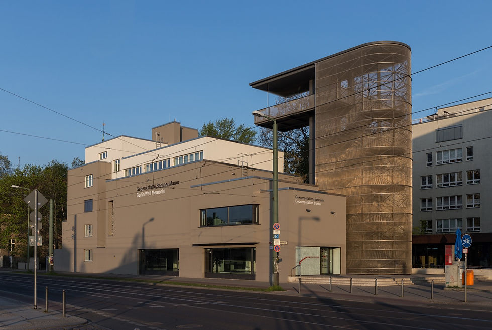
The viewing tower at Bernauer Strasse, the best place to see a full border section from above. Image by Ansgar Koreng via Wikimedia Commons, CC BY 3.0 DE.
What an overlay actually shows you
A Wall map overlay puts the 1989 border line on top of the present-day city. The good ones do three things a plain historical photo cannot:
They tell you which side of the Wall a specific point was on, East, West, or on the border itself.
They show how far that point sat from the actual fortification, which matters because the death strip was often wide.
They stay accurate to within a few metres, because the line is built from the city's own survey records rather than drawn by hand.
The map below is the one I use. Tap any point and it returns East, West, or on the Wall itself, plus the distance to the former line.
How to read where you are standing
Here is the routine that turns the map from a picture into a tool. It takes about ten seconds per spot.
Tap your current location, or type a street. Start with something you know, like your hotel or the café you are sitting in.
Read the side. If it says West Berlin, you are inside the old enclave. If it says East, you are in the former Soviet sector, which is where most of the historic centre sits.
Check the distance to the line. A point 400 metres from the border felt like a normal city. A point 20 metres from it lived with a wall at the end of the street.
Look for the on the Wall itself result. Anything within 25 metres of the line gets this, because at that range the boundary and the real fortification overlap. The Brandenburg Gate is the classic example: East Berlin territory, but the Wall ran in front of it, so it sat inside the death strip.
My advice: check your hotel before you arrive. If it comes back West, your daily walk into the centre crosses a border that did not exist for 28 years, and your U-Bahn line probably passes through at least one station that was sealed and patrolled as a ghost station for most of that time.
Overlay versus street view
People often search for a Berlin Wall Google Street View, hoping to see the Wall standing in the present-day scene. That does not exist, because the Wall is gone in almost every central location. What an overlay gives you instead is better for planning: it tells you where to point your own eyes. Stand at the spot, read the side, then look up. The double row of cobblestones, the bronze plaques, the gaps between buildings all start to make sense once the map has told you the line is right there.
For the full history behind the line, the interactive Berlin Wall map post walks through what the border actually was. If you want to know what physically survives today rather than just the route, I list it in what is left of the Berlin Wall.
Where the overlay stops and a guide starts
An overlay is very good at one thing: telling you where the line was. It cannot tell you what happened there. It will not mention the family that tunnelled under a particular street, or which window someone jumped from, or why one crossing was busy and another was a trap. That is the layer a map cannot hold.
The survey data behind any good overlay traces back to the Berlin Wall Foundation, which maintains the official record of the border path. The story on top of it is the part I add on the walk, which runs through the former East where the line crosses the route more than once. If you are weighing up whether to join one, here is how a tip-based free walking tour works.