Berlin Hiking Trails: The 20 Green Routes and Where the Trains Meet Them

The swimming half of the year is over. The state stopped testing the bathing water on 15 September, the staffed beaches are winding up their swimming weeks, and the light is going fast now. This is the point in the year when I stop planning Saturdays around water and start planning them around walking. It is also the point when I remember that Berlin has twenty signposted long-distance footpaths running straight through it, and that almost nobody who lives here has walked one.
They are the Grüne Hauptwege, the green main routes. The Senate has been plotting and waymarking them since 2004, and the marked network now covers about 575 km. I pulled the official route geometry out of the Berlin geoportal and measured it myself: 575.0 km, which for once matches the published figure exactly.
You have probably already walked a piece of one without noticing. Weg 19 passes Mauerpark and the Kulturbrauerei. Weg 18 crosses the top of Tempelhofer Feld. Weg 1 goes through the Tiergarten, behind the Kanzleramt and along the Spree past Hackescher Markt. The small white hiking bear on a green square is the sign for all of it.

Weg 13, the Barnimer Dörferweg, near Blankenfelde on the northern city edge in November. This is what most of the network looks like once you are past the S-Bahn ring.
What the twenty Grüne Hauptwege actually are
Each route carries a number from 1 to 20 and a name taken from the landscape it crosses. Eighteen of them run from one edge of the city to another. Two are rings: the Innerer Parkring (Weg 18, 52 km) and the Tiergartenring (Weg 19, 23 km), which both come back to where they started.
The shortest is the Bullengrabenweg in Spandau, 7 km. The longest is the Spreeweg, 63 km, from the border at Albrechtshof in Staaken out to Erkner.
A few things the Senate says on its own pages are worth reading before you go:
These are hiking routes, not accessible paths. The official wording is blunt. They are not barrier free, they can have steps, high kerbs, poor or missing lighting, and there is no claim to extra traffic safety. On maintenance tracks beside the waterways the surface can be rough.
Some sections cross fenced ground with closing times. Allotment colonies, cemeteries, parks such as Tempelhofer Feld. They shut in the evening, and the Senate cannot give one rule that covers all of them.
Waymarking is nearly finished but still patchy. There are fixed signposts with full direction arms, and stickers between them. The last six routes, numbers 1, 5, 7, 15, 16 and 17, were scheduled for their signs between March and summer 2026. Vandalism and building sites take individual markers out, so the official advice is to carry a map anyway.
All twenty routes are published as GPX, KML and printable PDF on the Senate's own route download page, updated every May. Put the file on your phone before you leave the flat, because the one place you will want it is the place with no signal.
Berlin hiking trails work in stages, not end to end
Here is what changed how I look at the whole network. I put the official route geometry next to every S-Bahn, U-Bahn and regional station in and around the city, and counted a station as being on a route when it sits within 1 km of the line.
282 station points touch the twenty routes, across 195 different stations. Take every pair of stations that share a route and you get 3,684 possible station-to-station walks. About 1,883 of them land between 2 and 12 km, which is a normal afternoon on foot.
So nobody has to walk the Teltower Dörferweg's 48 km. That one route alone has sixteen stations on it, which means you can start at U Onkel Toms Hütte and finish 12 km later at S Lichterfelde Süd, then pick the same path up months afterwards at U Rudow and walk it to S Johannisthal. The route is the shelf. The stage is the thing you actually do on a Saturday.
The tool below is built on exactly that. Set how long you want to be on your feet, and for every one of the twenty routes it works out the longest walk between two stations that still fits, and draws it on the real geometry.
I set the pace at 4 km/h on purpose. That is slow for a pavement and about right for a forest track with a gate, a stream crossing and one wrong turn in it. The walk from the platform to the line is already inside the distance, so a stage that reads 11 km really is 11 km of your day.
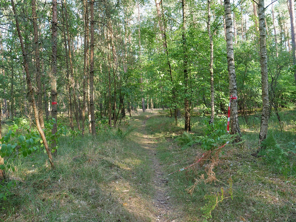
The Spandauer Forst, which Weg 2 crosses. Beautiful, and 16.7 km from the start of that route without a single station.
The routes with a station every kilometre, and the ones without
The network is far less even than the total suggests, and this is what decides whether a route is a casual plan or a committed one.
Easy to dip in and out of:
Weg 19, Tiergartenring. 28 stations on 23 km, and the widest gap between two of them is 2.5 km. Zoologischer Garten, Hauptbahnhof, Nordbahnhof, Eberswalder Straße, Jannowitzbrücke, Kottbusser Tor, Gleisdreieck and Potsdamer Platz are all on the line. If you want to find out whether you like this at all, start here.
Weg 18, Innerer Parkring. 54 stations on 52 km. The widest gap on the entire ring is 4.8 km, between Kurt-Schumacher-Platz and Jakob-Kaiser-Platz.
Weg 5, Nord-Süd-Weg. 32 stations on 44 km, running from the Brandenburg border at Röntgental down to Lichtenrade.
Routes where you commit:
Weg 2, Spandauer Weg. 33 km with exactly two stations near it, and the first 16.7 km has none at all. It begins at a ferry landing at Aalemannufer and ends at a bus stop in Kladow. That is a bus timetable day, not a spontaneous one.
Weg 13, Barnimer Dörferweg. Five stations on 34 km, with 16.7 km between S Karow and S Waidmannslust.
Weg 9, Dahmeweg. Three stations on 21 km. After S Grünau there is nothing for the last 11.9 km out to Schmöckwitzwerder.
Weg 1, Spreeweg is the split personality of the network. It has 40 stations, more than any route except the two rings, and it also holds the single longest empty stretch anywhere: 17.6 km from S Spindlersfeld to Erkner, along the Müggelspree and through Rahnsdorf.
Only eight of the twenty routes have a rail station at both of their official end points. Four of them, numbers 2, 4, 16 and 20, have one at neither end, which is why the official pages list a bus stop or a ferry pier as the start.
Several routes also run past the city limit or right up to it, so check what your ticket covers before you set out. Erkner, Griebnitzsee and Röntgental are all outside the AB zone, and the ticket zone rules decide whether the end of your walk costs you an extension.
What autumn does to these paths
Three things change between now and November, and all three are about the same hour of the day.
The light goes, and then it goes again. Sunset in Berlin today is 19:28. On Saturday 24 October it is 17:54. The clocks go back that night, so on Sunday 25 October it is 16:52, and by mid-November it is 16:15. On routes the Senate itself describes as having poor or missing lighting, an hour lost overnight is the difference between finishing in daylight and finishing by phone torch. I have done the last few kilometres of the Wuhletal in the dark, and it is not the walk you came for.
The gates start closing earlier. Tempelhofer Feld is the start and the finish of the Innerer Parkring. Through September its entrances shut at 21:30. From 1 October they shut at 19:00, and in November at 18:00. That is two and a half hours gone in a single night. The Tempelhofer Feld gate clock has the month-by-month times, and the same seasonal squeeze applies to the allotment colonies and cemeteries that several routes thread through.
The ground softens. The working tracks along the Wuhle, the Panke and the Teltowkanal turn heavy after a wet week. Weg 17, the Teltowkanalweg, holds up better than most, because most of it is a proper canal-side path with a firm surface.

Delfter Ufer in Britz, on Weg 17. This is the route I suggest when the rest of the network is wet.
Where I would start
If you have never walked one: the Tiergartenring, from S Tiergarten round to U Eberswalder Straße. That is about 10 km of Hansaviertel, Spreebogen, the Bernauer Straße end of Mauerpark and Prenzlauer Berg, with a station every few minutes if you want out early. You will recognise more of it than you expect, and you will also see how much green sits between the bits you already know.
If you want it to stop feeling like the city: Weg 14, the Wuhletalweg, from U Kaulsdorf-Nord down to S Wuhlheide. Roughly 7 km along a stream valley with Highland cattle grazing in it, ending in forest. The U5 puts you on it in about half an hour from Alexanderplatz.
If you want water: Weg 12, the Havelseenweg, S Pichelsberg to S Nikolassee. That is 11.3 km, and it is exactly the kind of long empty stretch I warned about above, so treat it as a full afternoon. The reward is the Havel on your right for most of it.

The Havel north of Spandau, where Weg 12 runs along the bank. Most of the Havelseenweg looks like this or better.
If you want the flattest introduction with a story attached: the middle of Weg 1, from S Tiergarten to S Treptower Park. That is 12.6 km straight through the old centre, and the section between the Hauptbahnhof and Hackescher Markt is the ground my free walking tour covers on foot in two hours. The route joins up things the tour can only point at, which is a good argument for walking it after the tour rather than before.

A Tiergartenring marker in Kreuzberg, near Möckernbrücke. On the inner routes the path is often a street you have walked a hundred times.
One move for this weekend
Pick one route number, find one stage on it that matches the time you actually have, and treat the rest of that route as a separate day. That is the whole trick. The people who bounce off these paths are the ones who look at 48 km and decide it is a project.
Check the sunset before you leave, because from 25 October the useful afternoon ends before five. And if you pick one of the sparse routes, look up where the second station is before you start, not while you are standing in a field in Buckow at half past four.

The Meskengraben at Rudow, on Weg 15. This is the Berlin city limit, a short walk from the end of the U7.
These routes are not a secret and they are not new. They are badly advertised, that is all, and the map that makes them usable, the one showing where a train already drops you onto one, is the thing that was missing.
Image credits
Source and licence details for the 6 photographs used in this article.
A gravel track on the Barnimer Doerferweg near Blankenfelde on the northern edge of Berlin: Lukas Beck, CC BY 4.0, via Wikimedia Commons.
A trail through birch woodland in the Spandauer Forst: Leonhard Lenz, CC BY-SA 4.0, via Wikimedia Commons.
The path along the Teltowkanal at Delfter Ufer in Berlin-Britz: Fridolin freudenfett, CC BY-SA 3.0, via Wikimedia Commons.
A path down to the Havel north of Spandau: Lukas Beck, CC BY 4.0, via Wikimedia Commons.
A Tiergartenring waymarker post on a street in Berlin-Kreuzberg: Boonekamp, CC BY-SA 4.0, via Wikimedia Commons.
A field gate at the Meskengraben in Berlin-Rudow on the Teltower Doerferweg: Fridolin freudenfett, CC BY-SA 4.0, via Wikimedia Commons.